
Hatcher’s Run • Strategic Situation • Petersburg Timeline
The Battle of Hatcher’s run was fought from February 5 – 7, 1865 about six miles southwest of Petersburg, Virginia along Vaughn Road and around Hatcher’s Run. The battlefield has changed relatively little in the 160 years since the Civil War. A few houses line the narrow country roads but the area so far has avoided much development. It is still mostly covered in woods and fields that wouldn’t look too out of place to the men who fought over them in 1865.

Unfortunately, only a small part of the battlefield is preserved. The Civil War Trust has saved around 380 acres of land north of Hatcher’s Run and west of Duncan Road, with another small parcel on the south side of Dabney Mill Road. (see map below)
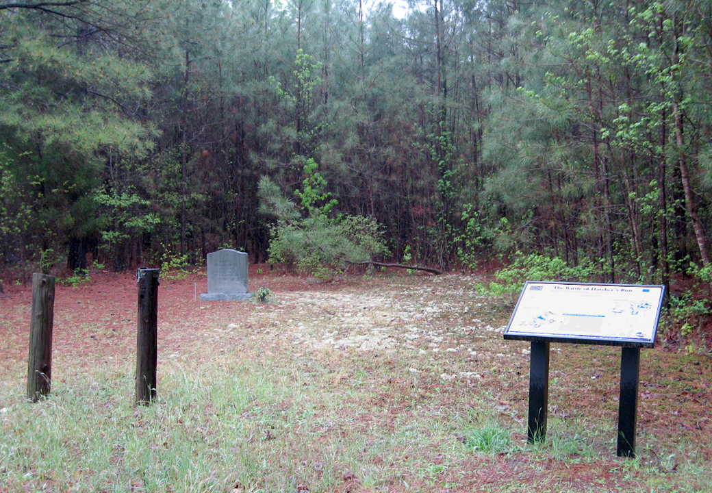
The Dabney Mill parcel has a small parking area, two wayside markers and a monument to Confederate Brigadier General John Pegram, who was killed nearby. A Virginia state historical marker and the Civil War Trust’s battlefield sign on the south side of the road show the location of the drive back to the parking area. These are the only signs that almost 50,000 men fought here for three days 150 years ago.
Monument and markers on the battlefild:
Battle Summary
By early February of 1865 the Siege of Petersburg had dragged on for eight months.The earthworks of the two armies stretched for miles across the Virginia countryside, starting east of the city and curving around it, ending about six miles southwest of Petersburg. Most of the supply routes into the town had been captured, but not all. Not much farther west Boydton Plank Road – today’s US Highway 1 – came into Petersburg from the southwest, and a short distance to the north the Southside Railroad carried the last remaining rail link to the hungry Confederates.
Time and again Grant had sent his men west, outflanking the Confederate lines and extending the Union lines a little farther to try to cut off the supplies, but these last two still eluded him. In spite of snow and sleet that draped the trees with ice (but firmed up the muddy roads) Grant decided to try again. The plan was for Brigadier General David Gregg’s Federal cavalry division to move west beyound the end of the Union earthworks and sweep the Boydton Plank Road of the traffic that Grant thought was there. To protect the cavalry Major General Andrew Humphreys’ Second Corps and Major General Gouverneur Warren’s Fifth Corps would take up protective positions between the cavalry and the watchful Confederates. Altogether around 34,000 Union troops were involved.
February 5
The Confederates did not know the Union infantry would just be acting as a shield. The Union movements looked like a repeat of the big offensive in the fall that had almost broken through to the railroad. Taking no chances, Lee spread his manpower in the sparsely manned trenches even thinner. This freed up John Gordon’s Second Corps of the Army of Northern Virginia, around 14,000 men, who were sent along with some Third Corps fores to counterattack and prevent the Federals from interdicting Boydton Plank Road or the Southside Railroad.
Gregg’s Union Cavalry quickly found that there was almost no Confederate supply traffic on the road. It was too close to Union lines and too dangerous to use. The Union infantry moved forward to cover the cavalry. In the afternoon Confederate infantry moved out from their defensive lines and launched three attacks on the Union forces around Armstrong’s Mill. All were turned back after heavy fighting. Afterwards the Union forces concentrated along Hather’s Run.
February 6
In the morning Union infantry launched attacks along Vaughan Road and at Dabney’s Mill. By the end of the day Vaughan Road had been cleared of Confederates. But Confederate Major General John B. Gordon’s men stopped Warren’s Fifth Corps at Dabney’s mill. During the fighting here (see marker) Confederate General John Pegram was mortally wounded (see monument). But Confederate reinforcements arrived and the Union left flank collapsed. Only the arrival of Union reinforements prevented a disaster. Nighfall and freezing rain and sleet ended the fighting and the Confederates entrenched.
February 7
Warren sent out men to scout the battlefield at first light and found the Confederates well dug in. He sent forward skirmishehers, but never found a weak poin a launched no major attack, although Confederate Brigadier General Moxley Sorrel was wounded. At the end of the day Warren pulled back.
The results
The two sides had fought back and forth for three days, ending in a tactical draw. The Union advance was stopped, but would not be forced back. The Federals dug in, having moved four miles closer to the vital railroad that kept Petersburg and Richmond alive.
The North had lost 171 killed, 1,181 wounded and 187 captured, a total of 1,539. The South lost around 1,160 men including two generals. Division commander Major General John Pegram was mortally wounded and brigade commander Brigadier General Moxley Sorrel was shot through the lung and disabled for the rest of the war. The end result was there were 1,160 fewer Confederates to man the ever-lengthening defensive lines, a desperate equation whose answer was quickly coming due.
The fighting extended the Union siege lines another three miles and forced the Confederates to do the same, even though they were already dangerously near the breaking point.
Location of the Civil War Trust’s Hatcher’s Run site
The site is on Dabney Mill Road. From exit 61 on Interstate 85 head 3.6 miles south on Boydton Plank Road (US1), then turn left (east) for 2.3 miles on Dabney’s Mill Road. (37.124846° N, 77.496985° W)